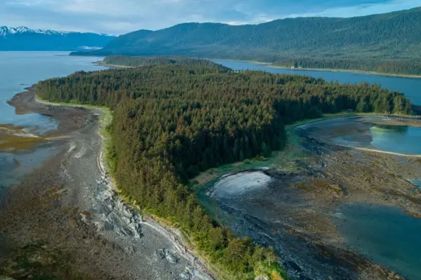
Alaska offers some of the most extreme geographies in the United States and some of the most iconic features readily known around the world, such as Mt. McKinely, now known as Denali, the Bering Sea from the TV show Deadliest Catch, the Trans Alaska Pipeline, and the mythical Yukon River. The Yukon River headwaters originate in Canada in the Yukon Territory. Its total length is approximately 2,000 miles long, with 1,267 miles of the Yukon River located in Alaska.
The Yukon River in the 1980s was much the same as early Gold Miners experienced in the late 1800s and early 1900s, as it served as the primary means of commercial transportation during the Klondike Gold Rush. Wooden paddle ships, also known as stern wheelers, were used throughout the Yukon River corridor. These early Pioneers had to be very hardy and resilient to endure the wilds of Alaska and the Yukon River in these early pioneering days. From the relentless mosquitos, so dense and aggressive, it was not uncommon to inhale them along with the extreme air temperatures in summer and winter. The daily challenge was also to navigate the Yukon and its tributaries, such as the Tanana River, Koyukuk River, Innoko River, and many others in the Yukon Delta. River channels change frequently, and water depths vary from river crossing to river crossing. The river channel would often move or go away until a new channel could be established; this was the most extreme on the Tanana River. River channel movement was often a byproduct of weather conditions; high water pushed channels outward and further down on crossings, and low water managed to scour out the channels and hold them up higher.
The paddle wheeler SS Nenana was built in Nenana, Alaska, by the Seattle Ship Building Company in 1933. She is 237 feet long with a beam of 42 feet, registered at 1000 gross tons. In 1933 the SS Nenana delivered freight, supplies, and people up and down the Yukon River. With the capacity to host up to 48 guests and 300 tons of freight. The SS Nenana was decommissioned and is displayed in Alaska Land Pioneer Park in Fairbanks. A new company that owned the rights to operate her, Yutana Barge Lines, began to modernize its fleet of vessels operating out of Nenana, Alaska, in the late ’50s and early ’60s. That modernization continued through the mid-’80s with the construction of purpose-built vessels such as the MV Anvik and MV Pastolic. Yutana Barge Lines had two flagship vessels built to replace the SS Nenana and its other outdated vessels, the MV Tanana and its sister ship MV Yukon. They are both approximately 100 feet long with beams of roughly 30 feet and powered by massive 6-cylinder direct reversible Enterprise engines. The MV Tanana and MV Yukon were state-of-the-art technology for that time. Shallow draft 48″ and flanking rudders, these two vessels began moving freight and fuel up and down the Yukon with 1200 tons of freight and half the crew required to operate the SS Nenana by comparison. The MV Yukon caught on fire in 1980 and was a total loss. The MV Tanana was sold off in the early 2000s and repurposed as a fish tender in Bristol Bay. Today there are two new purpose-built sister ships pushing barges up and down the Tanana and Yukon Rivers, named the MV Yukon and MV Tanana, that Ruby Marine operates out of Nenana, Alaska. These modern-era vessels, when headed upstream, can produce a very aggressive wake behind the tug in some circumstances. It was not uncommon for the path of these tugs to sink small watercraft, sitting lower in the water, loaded with supplies and gear.
The transition from solid fuel and paddle wheel technology to modern era petroleum fuel power and propeller technology was led by “Captain Allen Brown.” All knew him on the Yukon as Captain Brown, the last Master of SS Nenana. As the first Master of the MV Tanana, he held command until the late 70s. Captain Brown became Yutana Barge Lines’ port Captain until he retired in 1981. A requirement established by Captain Brown to be a Yukon River captain or pilot was for aspiring individuals to be able to draw the Yukon River from Fort Yukon downstream to all three mouths of the Yukon. As well as name all Islands, Villages, Creeks, and Sloughs and draw the navigable channel from memory. During the ’80s, there were just 12 people licensed and qualified to operate vessels on the Tanana River and Yukon River between Circle Alaska and its West Coast. Only a few individuals are known to have drawn the Yukon River from the arctic circle, from memory, in the mid-’80s.
The Yukon River is majestic, mythical, and can be very dangerous. The average peak water flows run approximately 300,000 cubic feet per second, and the river is cloudy with nearly zero visibility. In narrow portions of the Yukon, those flow volumes can double in areas like the Rampart Rapids and Pilot Rock or Bruno’s rock, about 20 miles below Galena. Captain Bruno was the only known Captain in the modern Yukon maritime era to have lost effective control of his tow. While coming downstream, fully loaded, he struck a massive rock nearly 300 feet tall and half a mile long, almost sinking the wooden tugboat the MV Taku Chief. Captain Bruno left a legacy of near misses, running aground, damaged equipment, and constant repairs to his tug and barges as the challenges of operating tugboats and barges on the Tanana and Yukon River were at the limits of his abilities and equipment. The Rampart rapids also claimed their share of victims, from stern wheelers to more modern tugboats. Boulders the size of freight trains stretch across the river, leaving about ¼ of its width navigable for the two-mile stretch of fast-moving deep water in the Yukon River Canyon.
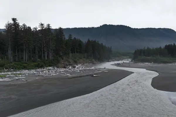
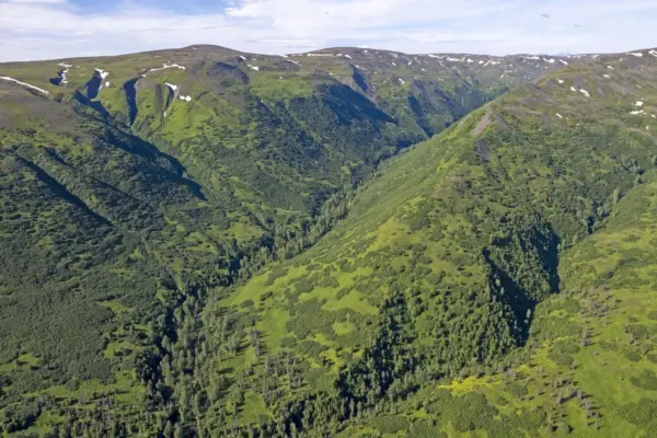
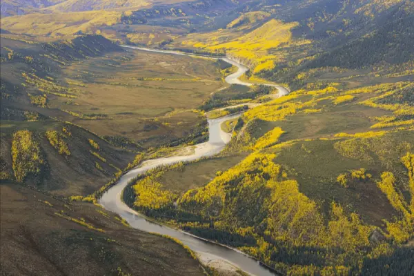
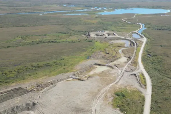
The Yukon River is accessible by road from the Dalton Highway, and the Yukon River bridge is also known as the E.L. Patton Bridge. This bridge over the Yukon is known as the 5-mile bridge to locals and is about halfway between Dead Horse Alaska and Fairbanks. The Dalton Highway is open year-round for those seeking an adventure on the Yukon. Travelers often use this access point to embark on their journey. The river channel is well defined and flanked by substantial hills when heading upriver from the Yukon River bridge. The north end of the Yukon River Canyon, 30 – 35 miles upstream from the 5-mile bridge, is the southwestern end of the Yukon River flats, contrasting the single channel, well-defined river. The Yukon spreads into multiple channels, all hiding its navigability by cloudy brown waters. These numerous channels vary by water depth, width, and length. Some will barely be a few inches deep, while others will be 10-12 feet deep. Navigating these waters from this point upstream to Circle Hot Springs becomes very challenging. Porcupine, Chandalar feeds into the Yukon Flats and an estimated 40,000 lakes and streams, protected under the Yukon Flats Protection Area.
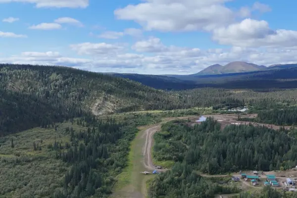
Big game and waterfowl hunting in the flats are popular. Stevens Village on the North Bank is a small community with 70 residents. Further upstream, also on the North Bank of the Yukon, is approximately 60 air miles but closer to 90 water miles is the town of Beaver, Alaska. According to the 2010 census, the population of Beaver, Alaska, was 80 residents. Further upstream, approximately 60 air miles is Fort Yukon, Alaska, also on the North Bank and once a US Government Radar station manned 24/7 365 days in the ’80s. From Fort Yukon upstream to Circle Hot Springs, another small Yukon River community population of 29, according to the 1990 Census, is arguably some of the most challenging and dangerous waterways on the Yukon inside the state of Alaska. This section is a tough stretch of river to navigate with countless fingers, sloughs, and channels that run from 8 feet to 8″ deep. In the ’80s, a 90′ Aluminum Passenger Carrying vessel was built by Nicholas Brothers Marine in Washington State, named the Yukon Queen. The Yukon Queen was a purpose tri-power jet boat built for the Yukon River to run in shallow water and to perform under extreme conditions, including shallow water. The Yukon Queen had three 500hp diesel engines and three-stage jet pumps for propulsion and was licensed to carry about 100 passengers. It ran aground several times during its first season operating on the Yukon River between Fort Yukon and Circle carrying tourists. During one particular event, the passengers had to be taken off the ship and transported back to Circle, and extensive repairs were made to her due to the very rocky bottom in this area.
Now with a brief history upstream from the 5-mile bridge, downstream is entirely different. Adventurers often use the access from the Bridge to embark on journeys such as rafting the Yukon, canoeing, and hunting the prized Yukon bull moose. Heading downstream from the 5-mile bridge, the walls of the Yukon River canyon climb taller and taller, nearly 1000 feet in places. The channel is very well defined, and the beauty of the tree-covered slopes and rocky outcropping is genuinely stunning in late August and early September. The birch trees are a brilliant yellow, the ubiquitous blueberry and wild rose bushes turn various shades of crimson, orange, and yellow, and coveted and edible rose hips are deep red and nearly purple. The canyon walls contain the mighty Yukon downstream for approximately 100 miles. Along the way, travelers will encounter several fantastic clear streams, the tiny town of Rampart on the South Beach of the Yukon, well known for the rich gold deposits outside of Rampart. In the Yukon River rapids, where many mariners have fell victim to the extreme current and water volume running between thousands of locomotive-sized boulders over the 2-mile stretch, the safe travel path is along the South shore. At the end of the Canyon rests Tanana, Alaska. Tanana is located on the North Bank, like most Yukon River communities, and sits across the river from the mouth of the Tanana River. The Tanana River is famous to many and infamous to others; it is intimidating to all.
The Tanana River, like the Yukon, is a milk chocolate color because it to suspends silt at such a concentration that visibility throughout the summer months ranges from 3″ to 6″, getting slightly better in the fall. Like the Yukon, the Tanana River does not warm much in the summer. The top 12″ of the river is warmer due to its inability to allow the sun to warm the lower water columns. Hunters, rafters, pilots, and locals alike unintentionally found themselves in the Tanana River and lived to tell their stories; without exception, those who managed to survive the frigid, fast-moving water and its countless dangers had a quality life vest on or someone nearby to affect a rescue. Those who have fallen into the river fully clothed, even being a strong swimmer. These individuals have lost the battle due to the volume of silt trapped in their clothes, weighing the swimmer down. Even people with life vests who have had unexpected opportunities to get in the river have learned how quickly the silt weighs down the swimmer and how dangerous being in the water can be. Peak surface water temps, during summertime, can reach the mid to high 50s, but 2-3 feet down, the water is still frigid because the silt prevents daylight from warming the river water below the surface.
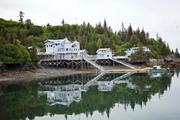
The Tanana River is 580 miles long, with its commercially navigable waters beginning near Fairbanks and roughly 260 miles downstream to its mouth. Nenana Alaska once served as the base of operations for what was originally Black Navigation which later became Yutana Barge Lines. The Tanana River shares similar traits as the Yukon River in the flats in that numerous channels, countless sloughs, and islands exist. Unlike the Yukon, the river bottom is almost exclusively silt. The river bottom changes, shifts, and moves by the river current and speed much the same way sand dunes on the surface are constantly changing by wind and rain.
Whether starting your Alaska River adventure or hunting expedition from the Yukon River or Tanana River, both Nenana and the 5-mile bridge offer boat ramps and river access. An adventure from Nenana to the 5-mile or 5-mile Bridge to Nenana would be epic. Expect to see moose, bear, wolf (rare to see with motors running), and countless other wildlife. Wildlife sightings inside the Yukon Canyon lean more heavily towards bears, and moose are seen frequently in the Yukon Flats area. On the Tanana River, things are happening very fast due to the current speed and perpetual shallow water, but it’s not uncommon to see moose and bears swimming in the river. Take your gold pan as there are numerous places along this journey to prospect while taking on fresh water.
About the Author:
Troy Dana was one of the 12 licensed to command work boats on the Yukon in the ’80s. He held a USCG Master’s License and traveled multiple times from the Arctic Circle to the Yukon River Mouth.